
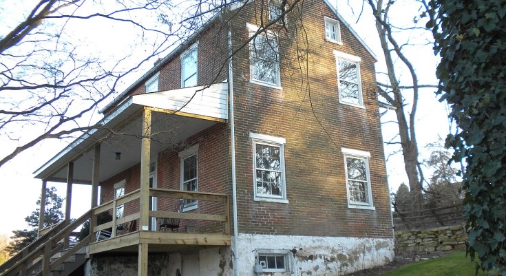
At sunrise, fog settles low across the fields near Hopewell Road, softening the outlines of old stone farmhouses and weathered bank barns scattered across East Nottingham Township. Cows move slowly through dew-covered pasture while the sound of tires on gravel fades quickly into the distance. Along the back roads near the Octoraro Creek corridor, the landscape still feels governed more by seasons than schedules.
It is easy to miss how much history unfolded here.
The rolling farmland and quiet stream valleys of southern Chester County appear calm now, but East Nottingham once stood at the center of one of colonial America’s most contentious border disputes — a contested territory claimed simultaneously by Pennsylvania and Maryland before the Mason–Dixon Line finally settled the matter. Long before that boundary became an American symbol, settlers here lived amid legal uncertainty, competing governments, and overlapping loyalties.
That complicated history still lingers subtly in the township’s landscape.
East Nottingham remains one of Chester County’s most rural municipalities, shaped by early Quaker settlement, Scotch-Irish farming traditions, and centuries of agricultural continuity tied to the original Nottingham Lots — the massive William Penn-era tract established in the early 1700s. Despite continued residential growth and increasing suburban pressure from nearby job centers, much of the township still preserves the physical character of an older southern Chester County.
“You can still drive these roads and understand why people stayed,” says a local historian familiar with the township’s archival work. “The land itself explains the history.”
The township’s earliest settlers arrived under competing visions of ownership.
Quakers established farms across the Nottingham Lots under Pennsylvania authority, while Maryland claimed large portions of the same territory through Susquehanna Manor, owned by George Talbot. Talbot renamed the area “New Connaught” in an effort to attract Scotch-Irish settlers loyal to Maryland’s claim. For decades, the region existed in a strange political limbo where competing land grants, taxes, and loyalties overlapped uneasily.
The eventual surveying of the Mason–Dixon Line brought legal clarity, but the township’s cultural landscape retained influences from both traditions.
That dual identity remains visible today in the township’s architecture and settlement patterns. Stone Quaker farmhouses stand beside properties reflecting Scotch-Irish agricultural traditions, their barns, springhouses, and outbuildings spread across long rolling fields divided by hedgerows and narrow rural roads.
Much of that historic landscape survives remarkably intact.
The Hopewell Historic District, listed on the National Register of Historic Places, preserves one of the region’s most evocative historical settings, straddling the border between East Nottingham and Lower Oxford townships. Developed around the Hopewell Cotton Works along Tweed Creek, the village emerged in the early 19th century as a self-contained industrial settlement where mills, worker housing, and farms formed a tightly connected rural economy.
Today the district still conveys the feeling of a place shaped by labor and landscape together.
Rows of stone and frame houses cluster quietly beside old mill structures while the surrounding farmland remains largely open. Unlike many former industrial communities absorbed into suburban development, Hopewell retains an almost isolated quality — a village that seems held gently in place by the surrounding countryside.
Beyond the historic districts, East Nottingham’s natural landscape continues to define daily life.
The Octoraro Creek corridor along the township’s western edge cuts through wooded ravines and broad floodplains where sycamores lean over slow-moving water. Deer move through the tree lines at dusk. Hawks circle above open fields. In many areas, the absence of dense development preserves long uninterrupted views across farmland and stream valleys.
For residents, that rural continuity remains central to the township’s identity.
Agriculture still plays a visible role here, even as many residents commute to nearby employment centers in Oxford, Newark, Wilmington, or the broader Philadelphia region. Equestrian properties, preserved farms, and low-density residential neighborhoods coexist across a landscape that has changed more gradually than much of southeastern Pennsylvania.
“There’s still breathing room out here,” says the historian. “That’s becoming harder to find.”
Even the township’s roads preserve echoes of its earlier character.
Many follow colonial alignments established long before modern traffic engineering reshaped the region. Narrow lanes curve naturally around hills, creeks, and old property lines rather than cutting directly through them. Stone walls appear unexpectedly beside fields. Farmhouses sit close to the road beneath towering trees planted generations ago.
As evening settles across East Nottingham, the last sunlight stretches low across the Octoraro valley while porch lights flicker on near Hopewell. The fields darken slowly. Crickets begin humming beneath the tree lines.
And somewhere beyond the barns and winding roads, the old boundary that once divided Pennsylvania from Maryland still runs quietly through the countryside — no longer disputed, but still shaping the landscape and identity of the township that grew around it.
Support the local news that supports Chester County. MyChesCo delivers reliable, fact-based reporting and essential community resources—free for everyone. If you value that, click here to become a patron today.